


Voting Districts not defined, Orleans Parish, Louisiana
About
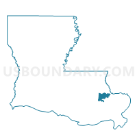
Outline

Summary
| Unique Area Identifier | 589881 |
| Name | Voting Districts not defined |
| County | Orleans Parish |
| State | Louisiana |
| Area (square miles) | 142.34 |
| Land Area (square miles) | 0.00 |
| Water Area (square miles) | 142.34 |
| % of Land Area | 0.00 |
| % of Water Area | 100.00 |
| Latitude of the Internal Point | 30.12029350 |
| Longtitude of the Internal Point | -89.96654060 |
Maps


Graphs
Select a template below for downloading or customizing gragh for Voting Districts not defined, Orleans Parish, Louisiana


Neighbors
Neighoring Voting District (by Name) Neighboring Voting District on the Map
- Precinct 17-20, Orleans Parish, LA
- Precinct 4-22, Orleans Parish, LA
- Precinct 4-23, Orleans Parish, LA
- Precinct 5-17, Orleans Parish, LA
- Precinct 5-18, Orleans Parish, LA
- Precinct 58, St. Bernard Parish, LA
- Precinct 7-37A, Orleans Parish, LA
- Precinct 7-41, Orleans Parish, LA
- Precinct 7-42, Orleans Parish, LA
- Precinct 8-30, Orleans Parish, LA
- Precinct 9-31D, Orleans Parish, LA
- Precinct 9-42C, Orleans Parish, LA
- Precinct 9-43F, Orleans Parish, LA
- Precinct 9-43G, Orleans Parish, LA
- Precinct 9-43I, Orleans Parish, LA
- Precinct 9-43J, Orleans Parish, LA
- Precinct 9-43K, Orleans Parish, LA
- Precinct 9-43L, Orleans Parish, LA
- Precinct 9-44A, Orleans Parish, LA
- Precinct 9-44D, Orleans Parish, LA
- Precinct 9-44E, Orleans Parish, LA
- Precinct 9-44F, Orleans Parish, LA
- Precinct 9-44G, Orleans Parish, LA
- Precinct 9-44J, Orleans Parish, LA
- Precinct 9-44O, Orleans Parish, LA
- Precinct 9-45, Orleans Parish, LA
- Precinct 9-45A, Orleans Parish, LA
- Precinct 909, St. Tammany Parish, LA
- Precinct 918, St. Tammany Parish, LA
- Voting Districts not defined, St. Tammany Parish, LA
- Voting Districts not defined, Jefferson Parish, LA
Top 10 Neighboring County Subdivision (by Population) Neighboring County Subdivision on the Map
- New Orleans city, Orleans Parish, LA (343,829)
- District 5, Jefferson Parish, LA (91,268)
- District 7, St. Tammany Parish, LA (20,017)
- District 10, St. Tammany Parish, LA (16,967)
- District 11, St. Tammany Parish, LA (15,920)
- District 13, St. Tammany Parish, LA (15,501)
- District E, St. Bernard Parish, LA (7,972)
Top 10 Neighboring Place (by Population) Neighboring Place on the Map
Top 10 Neighboring Unified School District (by Population) Neighboring Unified School District on the Map
- Jefferson Parish School District, LA (432,552)
- Orleans Parish School District, LA (343,829)
- St. Tammany Parish School District, LA (233,740)
- St. Bernard Parish School District, LA (35,897)
Top 10 Neighboring State Legislative District Lower Chamber (by Population) Neighboring State Legislative District Lower Chamber on the Map
- State House District 94, LA (31,652)
- State House District 100, LA (30,223)
- State House District 97, LA (25,853)
- State House District 101, LA (25,026)
- State House District 103, LA (23,643)
- State House Districts not defined, LA (0)
Top 10 Neighboring State Legislative District Upper Chamber (by Population) Neighboring State Legislative District Upper Chamber on the Map
- State Senate District 1, LA (89,479)
- State Senate District 3, LA (79,418)
- State Senate District 4, LA (71,484)
- State Senate District 2, LA (65,868)
- State Senate Districts not defined, LA (0)
Top 10 Neighboring 111th Congressional District (by Population) Neighboring 111th Congressional District on the Map
- Congressional District 1, LA (686,961)
- Congressional District 3, LA (637,371)
- Congressional District 2, LA (493,352)
Top 10 Neighboring Census Tract (by Population) Neighboring Census Tract on the Map
- Census Tract 408.03, St. Tammany Parish, LA (9,326)
- Census Tract 407.08, St. Tammany Parish, LA (6,044)
- Census Tract 17.25, Orleans Parish, LA (5,901)
- Census Tract 17.46, Orleans Parish, LA (4,296)
- Census Tract 17.24, Orleans Parish, LA (4,213)
- Census Tract 133.01, Orleans Parish, LA (3,453)
- Census Tract 17.45, Orleans Parish, LA (3,284)
- Census Tract 76.06, Orleans Parish, LA (3,147)
- Census Tract 133.02, Orleans Parish, LA (2,464)
- Census Tract 17.37, Orleans Parish, LA (2,463)
Top 10 Neighboring 5-Digit ZIP Code Tabulation Area (by Population) Neighboring 5-Digit ZIP Code Tabulation Area on the Map
- 70122, LA (28,564)
- 70126, LA (23,958)
- 70127, LA (20,471)
- 70128, LA (17,113)
- 70124, LA (16,824)
- 70129, LA (9,064)